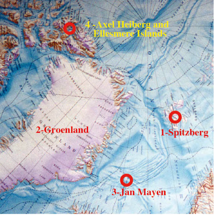
In the field of Earth and Climate Sciences, the research of the University of Lausanne in the polar regions began in 1908, when a professor of this university, Frédéric Jaccard, went to Spitzbergen. His research focused on paleontology and he also noted the evolution of glaciers. Then, for more than fifty years, from 1910 to 1963, the glaciology and climatology of the polar regions, from Spitzbergen to Greenland and the island of Jan Mayen, were among the subjects of study of another professor from Lausanne, Paul-Louis Mercanton, and from 1929 onwards, of one of his students, Andé Renaud. These researches will find their apotheosis in the program of the international glaciological expeditions in Greenland from 1957 to 1960.
The mapping of the sedimentary and metamorphic terrains of Greenland began in 1932 with the Danish geologist Lauge Koch who, for nearly thirty years, led international teams, in which 74 Swiss geologists participated, including Rudolf Trümpy who taught in Lausanne from 1948 to 1953. It was not until 1956 that the first geologist from the University of Lausanne took part in this mapping, followed in the following years by five others, all of whom would defend their thesis at this university. After the major phases of exploration and mapping of Greenland, it was two geologists who had studied in Lausanne, Arthur Escher from 1964 and his brother Jan from 1975, who contributed to the major syntheses of the geology of this polar region at the Greenland Research Centre in Copenhagen. Involved in mining research, Guy Della Valle, a graduate of Lausanne, will be involved in prospecting in South Greenland as early as 1975, which he will continue to explore until 2013, with more than 20 expeditions to his credit. Subsequently, two other geologists trained in Lausanne will participate in polar research in the fields of paleoclimatology, paleontology and the study of the great extinction at the end of the Primary Era, as well as in Greenland, Ellesmere and Axel Heiberg islands in the Canadian Far North and in Spitzbergen from where an expedition has just returned (2020).
It is already during the summer of 1908 that the professor of Paleontology of the University of Lausanne, Frédéric JaccardJaccard, went to Spitsbergen where he sampled the Miocene lignite sandstones and pointed out, in a meeting of the Société Vaudoise des Sciences Naturelles (SVSN), the very pronounced retreat of the Pointe du Renard glacier in Belsound Bay (Jaccard, 1909).
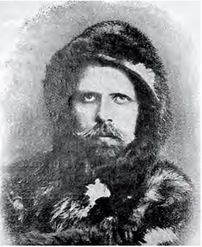
But the first important Swiss research in glaciology and climatology began in 1909 in Greenland with Alfred de Quervain and was reported in the illustrated newspaper "La Patrie Suisse n° 431". Alfred de Quervain, a glaciologist and climatologist from Bern and a citizen of Corsier, led a first expedition in 1909, which had an exploratory purpose, with Dr. Arnold Heim, a well-known Swiss geologist from Zurich. They were accompanied by Dr. Emile Baeber, a teacher in Zurich, and the meteorologist Stolberg from Strasbourg. They left Copenhagen on April 1, 1909, and reached Umanak on the 16th in the course of June. They left on July 3 for an exploration of the coast then of the ice sheet up to 100km towards the west and 1700m of altitude and returned on August 2 to the coast. The return is done with Dr. Cook on his famous boat of exploration of the pole.

Another professor from Lausanne undertakes research in the polar regions, it is Paul-Louis Mercanton who teaches electrical measurements and magnetism at the School of Engineering.
He also worked on meteorology and the study of glaciers, and in this field continued the teaching of Professor F.A. Forel from Lausanne, who was the initiator in 1895 of the international commission for the study of glaciers. Following his colleague Frédéric Jaccard, Paul-Louis Mercanton had the opportunity to go to Spitzberg in August 1910 to study the extension of glaciers and to present his research to the SVSN.
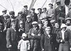
Two years later, in 1912, he was called to participate in Alfred de Quervain's second expedition to Greenland, the story of which is detailed in "Patrie Suisse n° 501". They were accompanied by the Zurich engineers R. Fick and K. Gaule, the meteorologists W. Jost from Bern and A. Stolberg from Strasbourg, as well as the doctor H. Hoessli from Basel. They left Copenhagen on April 2, 1912, and arrived on April 27 at Sisimiut on the west coast. In June, they left from the bottom of Disco Bay to a point called "Port Quervain" where the Mercanton team will organize all its explorations. It is also the starting point for the de Quervain team which reaches on July 12 the altitude of 2505m on the highest point of the ice sheet at nearly 300 km from the coast. On their return they discovered a mountain range (nunatak) which they named "Schweizerland" and gave the highest peak (2760 m.) the name of "Mont Forel" in homage to the scientist from Vaud who died in Morges, just before their return!


Focusing on the climate, the ice sheet and the retreat of its glaciers, these two Swiss expeditions are pioneers (Mercanton, 1916). They were later used as a basis for the current study of global warming and were published in 1925 by de Quervain & Mercanton.

In 1921, Professor Mercanton, who has been teaching geophysics and topography at the University of Lausanne since 1920, undertook an expedition to the island of Jan Mayen in the north of Iceland and succeeded in making the first ascent of Beerenberg, in the company of J.-M. Wordie. He published the following year the glacial system of this island (Mercanton, 1923) and he also took lava samples there, as he had done previously in Spitzbergen (1910) and Greenland in order to study the terrestrial magnetism recorded in them.

His observations revealed anomalies with reversals of the Earth's magnetic field. Mercanton (1926) was the first to propose that magnetism could corroborate the theory of continental drift and determine their movement. He pleaded in vain to pursue such studies with the International Union of Geodesy and Geophysics. It was not until three decades later that his hypothesis was confirmed as reported by Le Grand in 1989.
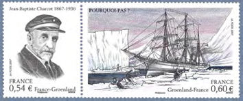
It is on board of the "Pourquoi Pas", Charcot's ship, that in 1929 and in 1931, Professor Mercanton went again to Greenland and to the island Jan Mayen accompanied in 1929 by the young André Renaud, licentiate in sciences of the Faculty of Lausanne. They made, among other things, geodetic measurements of the altitude of Beerenberg and again took basalts there, as well as in Greenland, for the further study of recorded magnetism (Mercanton, 1931-1932).

For more than 25 years, the work done in polar glaciology and meteorology was followed by Paul-Louis Mercanton and André Renaud. Then, in 1956, Swiss glaciologists and climatologists returned in force within the framework of the international glaciological expeditions to Greenland from 1957 to 1961 with Professors R. Haefeli of Zurich, H. Oeschger of Bern and A. Renaud of Lausanne, reported in Renaud (1958), with the publications on the physical and chemical studies of the ice of the Greenland ice sheet (Renaud, 1959, Renaud et al., 1963). The ice sheet, like the Alpine glaciers, is a very sensitive climatoscope, but it is likely to provide us, after further study, with information of great paleoclimatic interest. It is this more precise research that the "International Glaciological Expedition to Greenland" proposes (Renaud, 1958).
It is only in the second part of the 20th century that geologists from Lausanne will become involved in polar research in Greenland and their studies will be focused on the analysis and understanding of the rock cover surrounding the ice sheet and its glaciers. But, as early as 1932, it was the Swiss geologists trained in Zurich, Basel and Bern who were the first to be very concerned by the mapping of this rock cover of Greenland, under the direction of the Danish geologist Lauge Koch.
Eugen Wegmann, from Schaffhausen, who worked in Scandinavia and became a professor at the University of Neuchâtel in 1940, participated in the research program of Dr. Lauge Koch, one of the best experts on the geology of Greenland. He needs geologists with good cartography skills and thanks to Wegmann, many Swiss geologists, in particular from the Schaffhausen area and students of Professor Paul Niggli from Bern, will be invited, from 1932 to 1938, to participate in the exploration, first of the NE part of Greenland. Wegmann spent the summer exploring with Lauge Koch and then stayed during the winter of 1932-1933 on Ella Island. In the summer of 1933, the geologist Heinrich Bütler from Schaffhausen, a Devonian specialist, joined him and spent the winter of 1933-1934 still on Ella Island.


Wegmann and Lauge Koch prepared a large expedition for the summer of 1934, which was joined by young assistants who had just finished their doctorate in geology, René Masson in Bern and Augusto Gansser in Zurich. The latter recounts this expedition in the book dedicated to his wife "La moglie di un Geologo" (Gansser, 2000). It is also worth noting that in 1936 Arnold Heim, a Greenland pioneer, joined Augusto Gansser for the great Swiss geological expedition to the Himalayas.
In 1936, Lauge Koch launched a new two-year mission with wintering in which several young Swiss geologists participated, still with Wegmann and Bütler. They are Hans Peter Schaub and Andreas Vischer from Basel, Hans Stauber from Zurich and Wolf Maync from Bern who will spend the winter on the island of Ella.
In 1937, two new Swiss geologists, Hans Hübscher from Schaffhausen and Karl Kleiber from Winterthur, arrived and spent the winter of 1937 to 1938. They were joined in the summer of 1938 by the volcanologist Alfred Rittmann from Basel.
Bütler was joined by A. Mittelholser from Rothrist in 1938 and both spent the winter in Eskimonäs from 1938-1939 with an assistant from Schaffhausen, Peter Bachmann.
As for Wegmann, he will carry out all the exploration of the south and southwest of Greenland with Lauge Koch. A large part of the results will be published in German in the reports of the Society of Natural Sciences of Schaffhausen (Mitteilungen der Naturforschenden Gesellschaft Schaffhausen, Volume 16, 1940) as well as by the Geological Survey of Denmark in the "Meddelelser om Gronland".
It is after the war, in 1946, that the Geological Survey of Greenland based in Copenhagen was founded under the acronym GGU.

In 1948, the Swiss geologists Heinrich Bütler and Hans Stauber continued their research in Greenland after the war, still with Lauge Koch. Hans Stauber made the discovery of metalliferous deposits, especially of lead, at Mesters Vig (Kong Oscars Fjord), which were exploited from 1956.
In 1949, Emil Witzig from Schaffhausen joined Lauge Koch's mission with a photographer from Zurich, Othmar Schaffner. He spent the winter and continued his studies in 1950 and the summer of 1951. In the summers of 1952 and 1953 he returned with Bütler, who, as the only Swiss geologist, continued his research in 1954. But in 1956 he took a young geologist from Schaffhausen with him as an assistant: Dr. Hans Früh.
Centered on stratigraphic surveys, tectonics and cartography, the explorations led by Lauge Koch will allow an in-depth knowledge of the geology of Greenland. As explained by F. Heinis (1956), the participation of Swiss geologists (nearly 74!) in the expeditions was only possible thanks to the generous hospitality of the Danish government and the generous advances of the expedition leader, Dr Lauge Koch.
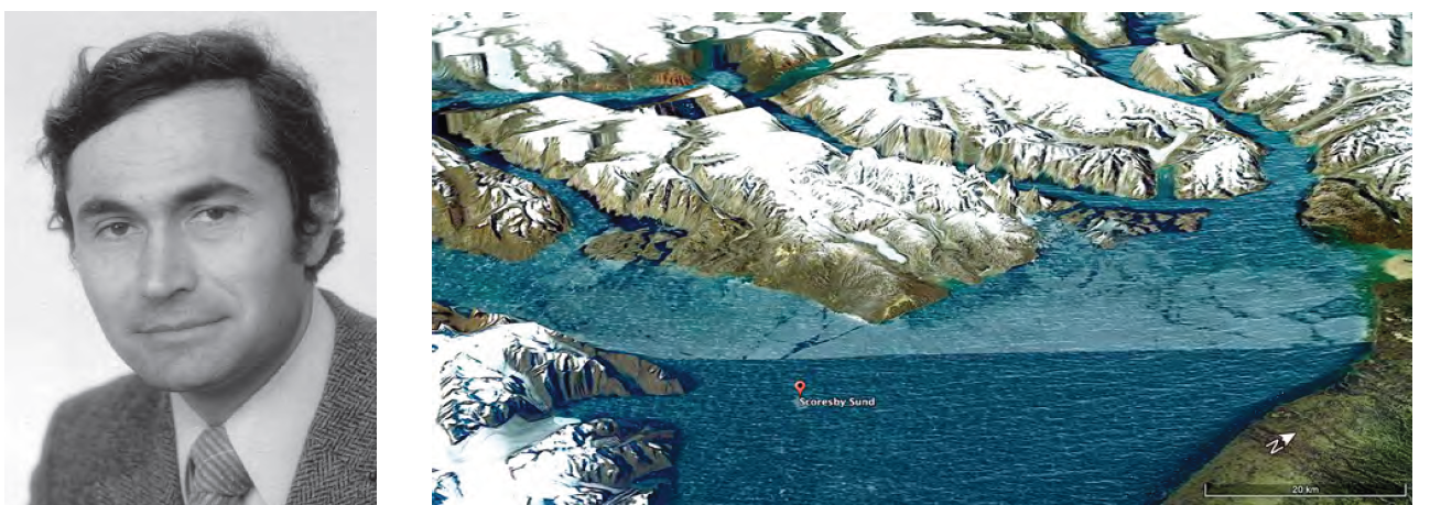
Rudolf Trümpy's first steps in his academic career were taken at the Institute of Geology of the University of Lausanne as a supervisor from 1948 to 1953. In 1954 he was appointed professor at the Swiss Federal Institute of Technology in Zurich (ETHZ). In 1958 he joined Lauge Koch in the study of sedimentary successions from the Primary to the Secondary Era on the east coast of Greenland, in the Scoresby Sund region, with three assistants. He followed in the footsteps of another Swiss geologist, Hans Stauber, who participated in Lauge Koch's expeditions from 1936 to 1938 with two wintering trips and who published a synthesis of the Triassic deposits of the East Greenland coast (Stauber, 1942). The mapping of these sedimentary terrains is the work of doctoral assistants Kurt Grasmück and M. Aellen from Zurich and Jean Putallaz from Fribourg. In 1967, Trümpy had the opportunity to return to the same region where he participated with Kummel and Teichert in the continuation of paleontological research on the early Triassic. Separately, each of them was able to provide new data on the Triassic deposits on this east coast of Greenland (Trümpy, 1960, 1969; Grasmück & Trümpy, 1969).

Note that this orientation in the detailed stratigraphy of the early Secondary Era of the polar regions will not only be followed by two future researchers from Lausanne, but extended to the paleoclimatology of this period and the study of the greatest extinction in the history of life. They are the undersigned (Aymon Baud) who made his career at the Geological Museum of Lausanne, and Hugo Bucher, who after his thesis in paleontology at the University of Lausanne, pursues his career as a professor of paleontology at the University of Zurich and at the ETHZ.
Eugen Wegmann, a professor in Neuchâtel since 1940, continues to follow the work being done in Greenland and informs his colleagues in the Geological Institutes of French-speaking Switzerland of the strong demand from researchers for the geological mapping carried out under the aegis of Denmark. He informs his colleague Héli BadouxHe was appointed in 1950 as an extraordinary professor at the Institute of Geology of the University of Lausanne. He passed on this opening to research financed by Denmark to his assistant who had just completed his doctorate, Marcel Burri. This one will be the first of the geologists who, following the professors Frédéric Jaccard and Paul-Louis Mercanton, will undertake research in the polar regions at the University of Lausanne, this time on Greenland.
This beginning is told by Marcel Burri in two stories that he entrusted to his friends and that bear the titles "Un géologue se souvient. In Greenland half a century ago" and "Memories".
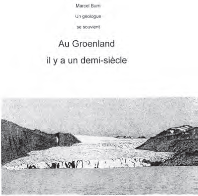
Marcel Burri was the first geologist from Lausanne to work for the GGU in Greenland, first in the southwest during the summer seasons 1956-57 and 1959. And later, in 1964, with Arthur Escher in the Disko Bay region of central West Greenland. Marcel Burri had the great merit to open the way for many geologists from Lausanne and Neuchâtel, some of whom will do their PhD work on the problems of superimposed tectonics of the outcrops of South and West Greenland. In summer 1956 Marcel Burri is the only geologist coming from the University of Lausanne and he is called to map the Ivigtut region (Ivittuut) in southwest Greenland.

In 1957, he was joined by Lausanne doctoral students Steve Ayrton, Marc Weidmann, Luc-Fran- çois Bonnard as well as Claude Froidevaux and Jacques Muller from the University of Neuchâtel, for the mapping of a vast region northwest of Ivigtut. In his memoirs, Marcel Burri recounts camp life with his four comrades from Lausanne (Burri, 2016).
In 1958, Steve Ayrton and Marc Weidmann returned to the north shore of Tiggsalup Ilua Fjord with Luc Bonnard to complete their mapping work, which would allow them to prepare their thesis.
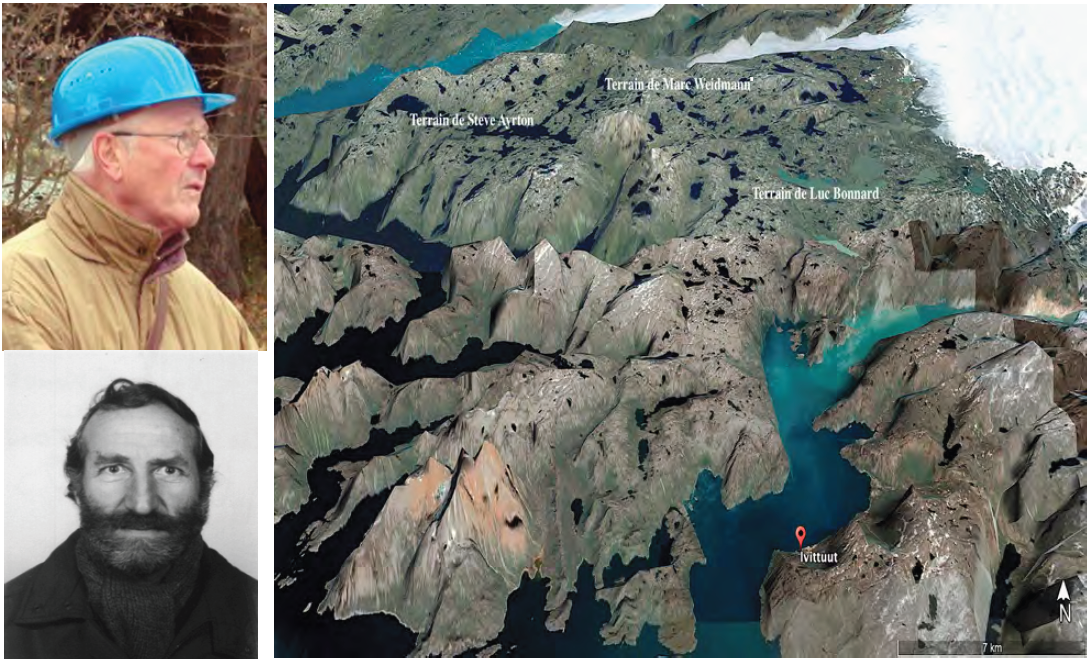
In 1959, Marcel Burri returned with Steve Ayrton to map the islands 50 km south of Ivigtut, accompanied by a new team of about thirty geologists. Appointed head of work at the Institute of Geology in 1957, Marcel Burri became a lecturer in 1963, and was promoted to extraordinary professor in 1968 (in geology and paleontology) and then ordinary professor in 1978. In 1989, for his 60th birthday, he tells the moving return on his field of Ivigtut.
On July 22, 1960, Steve Ayrton and Marc Weidmann each defended their thesis on studies done in their regions, respectively Ivigut and Tigssaluk fjord, in southwestern Greenland. On July 20, 1961, Luc Bonnard presented his thesis. These were published a few years later (Ayrton, 1963; Weidmann, 1964; Bonnard, 1971).
Steve Ayrton was appointed privat-docent of special mineralogy from 1966 to 1970, extraordinary professor of mineralogy-petrography from 1970 to 1978 and ordinary professor from 1978 to 1990. Marc Weidmann was a research assistant in paleontology and then, from 1968, a lecturer in micro-paleontology. He succeeded Professor Arnold Bersier as head of the Cantonal Geological Museum in 1969. As for Luc Bonnard, he will continue his career on the study of soils at the Federal Agricultural Testing Station near Zurich.
There are no people from Lausanne in the field in 1960, but it is in 1961 that Arthur Escher begins his work in Greenland. In 1962, he continued his studies in the Nanorlik region of southern Greenland, while Jacques Muller returned from Neuchâtel accompanied by a young assistant, Francis Persoz. Paul Buttet, who graduated in 1961, began a doctoral study in southwestern Greenland in 1962, but after two field seasons he abandoned it in 1964. On the other hand, Arthur Escher returned to Greenland in 1963 and presented his thesis on the Nanorlik region of southern Greenland in Lausanne on March 18, 1964 (Escher, 1966).
In the summer of 1964, he returned to the west coast in Disko Bay, accompanied by Marcel Burri, as the latter recounts in his 2016 account.


Arthur Escher was employed full time by the GGU and the University of Copenhagen from 1964 until 1975. After his successful years with very important publications at the Geological Survey of Denmark, Arthur Escher was called to the Geological Institute of Lausanne in 1975 as extraordinary professor of alpine geology and became ordinary professor in 1978.
It is in 1964 that the new graduate Henri Masson has the opportunity to undertake his thesis on the migmatitic complex of Isorssua, near Frederikshab, in the South-West of Greenland and he will spend three summers, from 1964 to 1966, to make his research there.
Henri Masson presented his thesis on July 10, 1970 and participated in the publication of several articles on Greenland. Lecturer in 1968, he was appointed privat-docent at the Institute of Geology in 1971, then, from assistant professor, he became full professor in 1979.

At the University of Basel, Dr. Albrecht Steck had the opportunity to carry out two field missions in the Scoresby Sund region in 1967-68 and presented his habilitation in 1969 on the Caledonian metamorphism of this region. He was hired at the Institute of Mineralogy of Lausanne as assistant professor in 1970 and became full professor in 1978.
It was in this Scoresby Sund region that Laurent Jemelin, a new graduate, began his thesis in 1970 on the region around Rolige-Brae, at the western edge of the Caledonian orogenic zone. For his first season, he was accompanied by another assistant, Peter Homewood. His second field season took place in 1972. Laurent Jemelin successfully defended his thesis on July 13, 1979.
Arthur Escher's younger brother, Jan Escher, finished his geology degree in Lausanne in 1968 and went to work for the Geological Survey of Greenland. He completed his doctoral thesis there in 1971, and was hired full time in 1975 to be in charge of synthesis work.
In addition to the elaboration of their doctoral theses, the geologists from Lausanne will participate in numerous publications on the geology of Greenland. They will also contribute, directly or indirectly, to the following synthesis publications:
- -1970. First general geological map of Greenland at 1:2,500,000 scale (Tectonic/Geological Map of Greenland, A. Escher, N. Henriksen, P. Dawes & A. Weidick).
- -1976. Geology of Greenland, Arthur Escher and W. Stuart Watt editors, 603 pp. This book contains contributions from 19 authors and covers all aspects of the geology and glaciology of Greenland.
- -1995. New general geological map of Greenland at the scale 1:2 500 000. Compiled by Jan Escher, Niels Henriksen and Chris Pulvertaft. This map also shows interpretations of offshore data and aeromagnetic measurements under the ice sheet.


It is likely that the field work that young geologists from Lausanne were able to undertake in Greenland and the solidarity born of common or similar adventures favored the promotion and the expected renewal of the faculty of the Institutes of Geology and Mineralogy of the Faculty of Sciences of the University of Lausanne at the end of the 1970s.
.
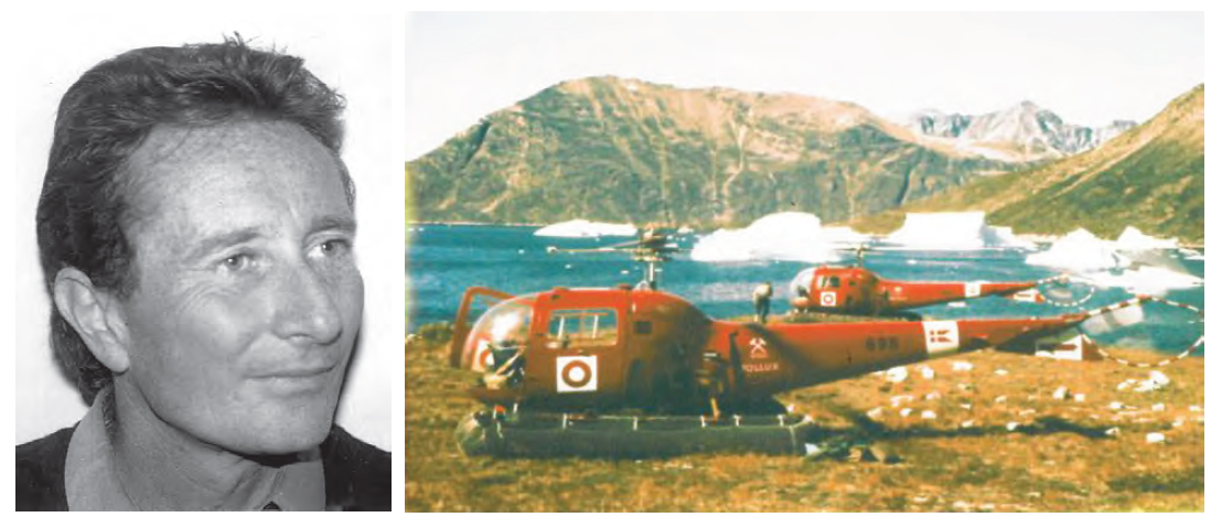
Among the young graduates trained in Lausanne, Guy Della Valle will be the one who will participate, from 1975 to 2013, in the greatest number of expeditions to Greenland. There were more than twenty of them, including ten on the west coast, eight on the east coast and two in the far north, in Peary Land. Attracted by the Arctic for a long time, first by his readings of polar explorations, including the first crossing of the islands to Greenland by Fidjof Nansen, or the accounts of Paul Emile Victor, the slides of Greenland, used as a support of course by the professors Mar- cel Burri and Steve Ayrton confirmed him in this vocation. However, coming after Laurent Jemelin, he was the only candidate from Lausanne, proposed as a doctoral student by Marcel Burri, to have been refused, this due to an unfortunate temporary interruption of the expeditions of the Greenland Geological Survey (GGU) mapping program.

With a mountain guide's certificate in his pocket, and thanks to a fortunate combination of circumstances, he found his first job, after his geology degree, at the Black Angel mine in 1975. He went on to do field seasons there in 1976, 1977 and 1979, and returned at irregular intervals until 2007. The Black Angel mine, located in the Umanak district on the west coast of Greenland, owes its name to the angel shape of the black shales, folded into the white marbles.

Thereafter, Guy Della Valle's expeditions were mainly mandated by Canadian and Danish mining exploration companies, and occasionally by a Swiss geological survey, or by his own company, Nunatak Exploration, registered in the Commercial Register since 2008. In 1987, he was hired for his climbing skills to carry out a vertical cliff sampling of rare earth contents in the Illimaussaq alkaline intrusion in southwest Greenland. In 1988 and 1989 he worked on the search for platinum and gold occurrences in the Skaergaard and Kap Edward Holms gabbro intrusions, this time on the east coast of Greenland. Two geologists from Lausanne were able to join him temporarily, R. Tito Haarpaintner and Jean Savary. The banded gabbro intrusion of Skaergaard is an important geological site, where Bowen's observations allowed him to define his law of fractional crystallization of magmatic rocks, or Bowen's reaction series. In September 1989, he returned to Ivigtut on the west coast, where he met with Christian Bugnon, a graduate of Lausanne, to evaluate potential cryolite reserves, and then to sample the blue sodalite granites as part of a regional ornamental rock study. He also met Marcel Burri who came on a pilgrimage to the field of his first steps in Greenland on the occasion of his 60th birthday, as Marcel tells in his album "Souvenirs". In 1990, Guy Della Valle continued his research for lead and zinc in Nugssuaq, north of the regions already studied on the west coast, with the help of two young geologists from Lausanne, Pierrick Danton and François Menthonnex.
1991 was then a busy year, as he first undertook, with Christian Bugnon, the continuation of a reconnaissance for ornamental rocks in southwest Greenland, around Narsaq. Then he went to the east coast to continue his reconnaissance program for platinum in the Kap Edward Holms area and nickel in the Nansen Fjord area.
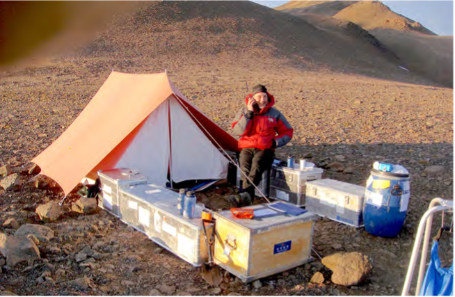
In April 1993, in winter conditions that allowed safe travel on the fjord ice, he participated in a very adventurous exploration of mineral resources in Peary Land, which is in the far north, and in the discovery of massive sulphide deposits of lead and zinc in Citronen Fjord. A Greenland Geological Survey bulletin will be issued following this exploration (see illustration above).
In 1995 he became interested in nickel and gold occurrences in southwest Greenland, as far as Kap Farwell. In 1996, he focused on gold occurrences of Tertiary volcanic origin in Kap Simpson, east-central Greenland, and in 1997, he embarked on new diamond exploration in the southwestern part of Greenland, in the Archean between Sondre Sromfjord and Ivigtut.
In 1998, it was further north, in Washington Land, that he studied indications of zinc encased in carbonates. The access to Washington Land, by boat in the middle of the ice, from the former American base of Thule, between Ellesmere Island in Canada and northwest Greenland, in the Kennedy Channel, gave an impressive idea of the difficulties to be overcome by the first explorers under sail. The campaign was cut short by the captain who did not want his ship to be stuck in the ice until the end of the summer of the following year!
In 1999 he continued his diamond exploration research in the Skjoldungen region, with R. Tito Haarpaintner, this time on the east coast of Greenland. In 2000, with Mario Sartori, another former Lausanne graduate, he was commissioned to carry out a structural study and mapping of the marbles of the Black Angel concession.
His research in Greenland will resume in 2006 and 2007 and he will return to the Black Angel mining area near Umanak, for a new company (see illustration).

From 2008 to 2012 various exploration programs for iron and gold are taking place in the Disko Bay area on the west coast of Greenland, for molybdenum in Flammejfeld, next to Skaergaard, on the east coast of Greenland, and for copper in the Kronprins Christian Land area, northeast Greenland, via Spitsbergen. In 2009 a sampling and drilling program for rare earths in the Safartoq carbonatite complex, southwest Greenland, next to the Sondre Stromfjord airport, led to the discovery of the Safartoq deposit. Finally, in 2013, his last mission was to Jameson Land, on the east coast of Greenland, to search for copper. His research did not result in publications, but in numerous exploration reports, currently available in the archives of the Greenland Geological Survey in Copenhagen.
Christian Bugnon has been working for 9 years in applied geology and in 1988, the Schindler office where he works, initiates the prospecting of ornamental rocks in Greenland and applies for a concession in association with Guy Della Valle who is already working there. In 1989, Christian made an appointment with Guy Della Valle and they prospected together in the Ivigtut area, then he continued alone in the Nanortalik area. In 1990, Christian had Antoine Burri do some core drilling using a hand drill lent by the Lausanne geology laboratory at one of the locations chosen in 1989. Then, as the Geological Survey of Greenland launched and financed a large project for this research, he was invited in 1990, as a Swiss expert, to continue the exploration and with his Danish colleagues he went to cover the whole region between Ilulissat and Tassiussak.

To complete the work on two missing communes, he returned in 1991 to the Fiskenaesset area in southwest Greenland and then to Ummannaq further north and a first report was published in the Geological Survey. The final results are given in a volume (Open File) of the Geological Survey of Greenland.
During the summers of 1992 and 1994, the undersigned (Aymon Baud) was invited by the Geological Survey of Canada to carry out stratigraphic surveys of the Permian-Triassic transition of Ellesmere and Axel Heiberg Islands in the Canadian High Arctic. He presented his results at several conferences and participated in several publications on the stratigraphy and paleontology of the Canadian High Arctic related to the Great Extinction (Baud et al., 2008, 2014; Beauchamp & Baud, 2001; Henderson & Baud, 1997) and important collections were deposited at the Geological Museum of Lausanne, where he was the director until his retirement in 2003.


Hugo Bucher is another geologist trained in Lausanne from 1982 to 1990 by the group of professors who started their career in Greenland. But before the beginning of his studies, he already had the opportunity to go to Spitzbergen in 1979 for a study of Lower Triassic marine vertebrates with his French colleague Mazin. D. in paleontology at the Faculty of Sciences of the University of Lausanne on Nov. 23, 1990, his post-doc in Vancouver and five years at the University of Lyon1, he succeeded Hans Rieber as chair of paleontology at the University of Zurich. In collaboration with colleagues specializing in Early Secondary Era fossil fishes, he undertook a mission to Spitsbergen in 2005 to assist in the dating of fossil layers (Brinkmann et al., 2010) and returned in 2017 with palynologists. The last mission was in 2020.


Following in the footsteps of Professor R. Trümpy, Hugo Bucher obtains funding for the study of the Early Triassic sedimentary series in Greenland and has the opportunity to carry out five field missions, from 2009 to 2012 in the Kap Stosch area and in 2019 in the Oksedal area . The first results concern mainly the palynology of the early Triassic and correlations with layers of the same age, on both sides of the Atlantic, as well as the high resolution analysis of organic Carbon isotopes (Sanson-Barrera et al., 2015; Schneebeli-Hermann et al., 2017) . Further results are expected on early Triassic paleontology and geochemistry in new sections on the East Greenland coast.
It is within the framework of a vast multidisciplinary research program -Sinergia, supported by the Swiss National Science Foundation with the Universities of Lausanne, Geneva and Zurich that Hugo Bucher had the unique opportunity to organize a mission to Spitsbergen in August 2020 to study fossiliferous marine sediments older than 247 million years with Franziska Blattmann, a doctoral student in geochemistry from the University of Lausanne. They were able to bring back an important collection of samples that will be analyzed from this fall 2020 in the geochemistry laboratories of the Geopolis building of the University of Lausanne.
As for Professor Samuel Jaccard of the Institute of Earth Sciences of the University of Lausanne, he participates with a group of students in the new "Green Fjord" project of the Swiss Polar Institute, dedicated to the study of paleoenvironments and climate change in this region of southern Greenland (2022-2026).


- Ayrton, S. N. (1960). A contribution to the geological investigations in the region of Ivigtut, SW Greenland. Ph.D. thesis, Faculty of Science, University of Lausanne, published 1963 in Medd. om Gronland, Bd. 167, Nr. 3, 139 p.
- Ayrton, S., & Burri, M. (1963). Selective granitization of basic veins in the Qagssimiut area, SW Greenland. Eel. geol. Helvet, 56, 809-816.
- Ayrton, S. N., & Burri, M. (1967). The evolution of the Precambrian basement in the Qagssimiut area, southern Greenland: Grønlands geologiske undersøgelse.
- Ayrton, S. N., & Masson, H.,1972. Crocidolite mineralization from the SW coast of Greenland - An example of sodium metasomatosis. - Bull. suisse Min. Petr.,52, 2, 277-316.
- Baud, A., 2002. A short review on the Permian-Triassic boundary and the Griesbachian substage. In STS/IGCP 467 Field Meeting, Budapest, Sept. 3-7, 2002, Abstract book and Poster.
- Baud, A., Nakrem, H. A., Beauchamp, B., Beatty, T. W., Embry, A. F., and Henderson, C. M., 2008, Lower Triassic bryozoan beds from Ellesmere Island, High Arctic, Canada: Polar Research, v. 27. 428-440.
- Baud, A., 2014: The global marine Permian-Triassic Boundary: over a Century of adventures and controversies (1880-2001). Albertiana 42, 1-21.
- Beauchamp, B., and Baud, A., (2002): Growth and demise of Permian biogenic chert along NW Pangea: evidence for northern sea ice, thermohaline circulation and end-Permian global warming. Paleogeography, Paleoclimatology, Paleoecology, Vol. 184, p. 37-63.
- Bonnard, L. F., 1960. Geology of an area between the Arsuk and Sermiligârssuk fjords, N of Ivigtut (SW Greenland). D. thesis, Faculty of Science, University of Lausanne, published 1971 in Medd. om Gronland.
- Brinkmann, W., Romano, C., Bucher, H., Ware, D., & Jenks, J. (2010). Palaeobiogeography and stratigraphy of advanced Gnathostomian fishes (Chondrichthyes and Osteichthyes) in the Early Triassic and from selected Anisian localities (report 1863-2009): Literaturbericht. Zentralblatt für Geologie und Paläontologie. Teil 2, 2009(5/6), 765-812.
- Della Valle, G. & Denton, P. 1991: Geological report on the 1990 zinc and lead exploration programme in central Nûgssuaq peninsula, Marmorilik Formation, West Greenland, 17 pp. Unpublished report, Intergeo-Exploration (in archives of Geological Survey of Denmark and Greenland).
- Escher, A. (1966). The deformation and granitization of Ketilidian rocks in the Nanortalik area, S. Greenland: Grønlands geologiske undersøgelse.
- Escher, A. 1967.Tectonic levels in the Precambrian of South Greenland. In: Etages Tectoniques. La Baconnière. Neuchâtel, 141-150.
- Escher, A. & Burri, M. I967 Stratigraphy and structural development of the Precambrian rocks in the area northeast of Disko Bugt, West Greenland. Rapp. Gronlands geol. Unders. 13, 28p
- Escher, A. et al. 1970 Tectonic/geological map of Greenland, scale 1:2 500 000. Geological Survey of Greenland.
- Escher, A. (1971). Geological Map of Greenland, Søndre Strømfjord-Nûgssuaq, M 1: 500.000.
- Escher, A., & Watt, W. S. (1976). Geology of Greenland. Copenhagen: Geological Survey of Greenland. Vol. 603.
- Escher, J. C., & Pulvertaft, T. C. R. (1995). Geological Map of Greenland, scale 1: 2,500. 000, Geol. Surv. Den. Greenl., Copenhagen.
- Galfetti, T., Hochuli, P. A., Brayard, A., Bucher, H., Weissert, H., & Vigran, J. O. (2007). Smithian-Spathian boundary event: Evidence for global climatic change in the wake of the end-Permian biotic crisis. Geology,
35(4), 291-294. - Grasmück, K. & Trümpy, R. 1969: Triassic stratigraphy and general geology of the country around Fleming Fjord (East Greenland). Meddelser om Gronland 168/2, 1-71.
- Jaccard, F. 1908. Relation of a trip to Spitzbergen. Bull. S.V.S.N., 45 .
Jémelin, L. (1979). Etude géologique de la région autour de Rolige-Brae: à la bordure occidentale de la zone orogénique calédonienne: Scoresby-Sund, East Greenland (Thesis, University of Lausanne). - Masson, H., 1970. Petrography and tectonics of the Isorssua migmatitic complex (Frederikshab, SW Greenland). 1970. Ph.D. thesis, Faculty of Sciences, University of Lausanne.
- Masson, H., Chessex, R., & Delaloye, M. (1971). "Total lead" ages determined on Precambrian zircons from the Frederikshab area (southwest coast of Greenland). Schweizerische Mineralogische und Petrographische Mitteilungen, 51, 179-192.
- Mercanton, P-L., 1910. Magnetization of diabases from Spitzbergen. Bull. SVSN 46, 1910.
- Mercanton, P-L., 1913. The glaciological work of the Swiss Expedition to Greenland, 1912-1913. "Le Globe", Geneva.
- Mercanton, P-L., 1916. Movement of the Greenland Ice Sheet. Arch. Sc. Geneva, 42, 495-96.
- Mercanton, P-L., 1920. in Quervain, A. de et al, Wissenschaftl. Ergebnisse der Schweizerischen Grönland-Expedition 1912-1913, Nouveaux Mémoires SHSN, 53.
- Mercanton, P-L., 1923. The Beerenberg glacier system of Jan Mayen. Arch. Sc. Geneva, 5, 417-418.
- Quervain, A. de & Mercanton, P-L. (1925). Scientific results of the Swiss expedition to Greenland 1912-1913 (With 4 pl. and fig.). Meddelelser om Grönland, Bd. 59, 55-71
- Renaud, A. 1958. The participation of Switzerland in the international glaciological expedition to Greenland -E.G.I.G.- from 1957 to 1961. Revue internationale de l'horlogerie, 8.
- Renaud, A. (1959). Physical and chemical studies on the ice of the Greenland ice sheet, Medd. Greenland, 2, 100-107.
- Renaud, A., Schumacher, E., Hughes, B., Oeschgerand, H., & Mühlemann, C. (1963). Tritium variations in Greenland ice. Journal of Geophysical Research, 68(13), 3783-3783.
- Sanson-Barrera, A., Hochuli, P. A., Bucher, H., Schneebeli-Hermann, E., Weissert, H., Adatte, T., & Bernasconi, S. M. (2015). Late Permian-earliest Triassic high-resolution organic carbon isotope and palynofacies records from Kap Stosch (East Greenland). Global and Planetary Change, 133, 149-166.
- Schneebeli-Hermann, E., Hochuli, P. A., & Bucher, H. (2017). Palynofloral associations before and after the Permian-Triassic mass extinction, Kap Stosch, East Greenland. Global and planetary change, 155, 178-195.
- Stauber, H. 1942: Die Trias Ablagerungen von Ostgronland. Meddr Greenland 132/1.
- Steck, A. 1969: Kaledonische Metamorphose der praekambrischen Charcot Land Serie, Scoresby Sund, Ost-Grönland. Habilitation diploma at the University of Basel, published 1971 in Bulletin Grønlands Geologiske Undersøgelse 97, 69 pp.
- Trümpy, R., 1960: Uber die Perm-Trias-Grenze in Ostgronland und über die Problematik stratigraphischer Grenzen (vorlaufige Mitteilung). Geol. Rundschau, 49, 97-103.
- Trümpy, R.,1961: Triassic of East Greenland, in Raasch, G. O. (ed.) Geology of the Arctic 1, Toronto U.P., 248-254.
- Trümpy, R. 1969: Lower Triassic ammonites from Jameson Land (East Greenland). Meddelser om Gronland 168/2, 81-116.
- Trümpy, R., 1972. Permian System. in Callomon, J. H., DT, Donovan & Trümpy, R., An annotated Map of the Permian and Mesozoic Formations of East Greenland. Meddelelser om Greenland, 168/3, 6-9.
- Trümpy, R., 1972. Triassic System. in Callomon, J. H., DT, Donovan & Trümpy, R., An annotated Map of the Permian and Mesozoic Formations of East Greenland. Meddelelser om Greenland, 168/3, 10-14.
- Weidmann, M. (1962). Geology of the area between Tigssaluk fjord and Sermiligârssuk fjord (middle part). SW-Greenland. Ph.D. thesis, Faculty of Science, University of Lausanne. Published 1964 in Meddr. Gronland, 169(1), 1-146.